


Kids maps are a valuable tool for both education and exploration. They provide children with a visual representation of the world and help them develop important cognitive and geographical skills. In today's digital age, finding the best kids map can be a challenge, but it is well worth the effort. Let's explore why maps are so important for kids and what features to look for in a high-quality map.
Understanding the Importance of Maps for Kids
Maps are essential tools for building children's geographic knowledge. They help kids learn about continents, countries, cities, and natural features like mountains and rivers, while introducing key concepts such as latitude, longitude, the equator, and the prime meridian.
Enhancing Geographic Knowledge
Maps serve as a visual tool to help children make connections between different locations and understand the relationships between them. By studying maps, kids can learn about the diversity of cultures and environments around the world. This knowledge fosters a sense of global awareness and understanding.
Boosting Cognitive Skills
Using maps helps children develop critical cognitive skills. Reading maps requires spatial reasoning, attention to detail, and the ability to follow directions. It also strengthens problem-solving and decision-making by encouraging kids to interpret symbols and navigate routes.
Encouraging Curiosity and Exploration
Kids maps stimulate curiosity and encourage exploration. When children see the vastness of the world on a map, they become curious about different places and cultures. Maps can inspire them to learn more about historical events, geographical phenomena, and the wonders of the natural world. By sparking curiosity, maps promote a lifelong love of learning.
Furthermore, maps can also provide children with a sense of adventure and excitement. The possibilities are endless, and the sense of wonder that maps evoke can ignite a child's imagination. In addition to fostering a love for exploration, maps also promote environmental awareness by highlighting national parks and natural features, allowing kids to develop a deeper understanding of the importance of preserving nature. They can learn about the balance between human activities and the natural world, inspiring them to become stewards of the environment.

Features of a Good Kids Map
When searching for the best kids map, there are several features to consider that can enhance the learning experience.
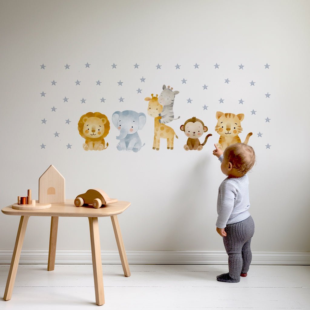
A great kids map should match the child’s age and be visually engaging, with bright colours, clear labels, and easy-to-read symbols. It should be fun, educational, and simple to understand.
Interactive Elements
To make learning interactive and engaging, a good kids map should include interactive elements. This could be in the form of pop-ups, flip panels, or QR codes that provide additional information when scanned. Interactive maps keep children actively engaged and help them retain information more effectively.
Educational Content
A high-quality kids map should go beyond geographical information and provide educational content. This could include facts about countries, famous landmarks, animals, and historical events. Maps with educational content make learning fun and inspire kids to explore different subjects.
Types of Kids Maps
There are various types of kids maps available, each serving a different purpose. Let's explore some of the most common ones.
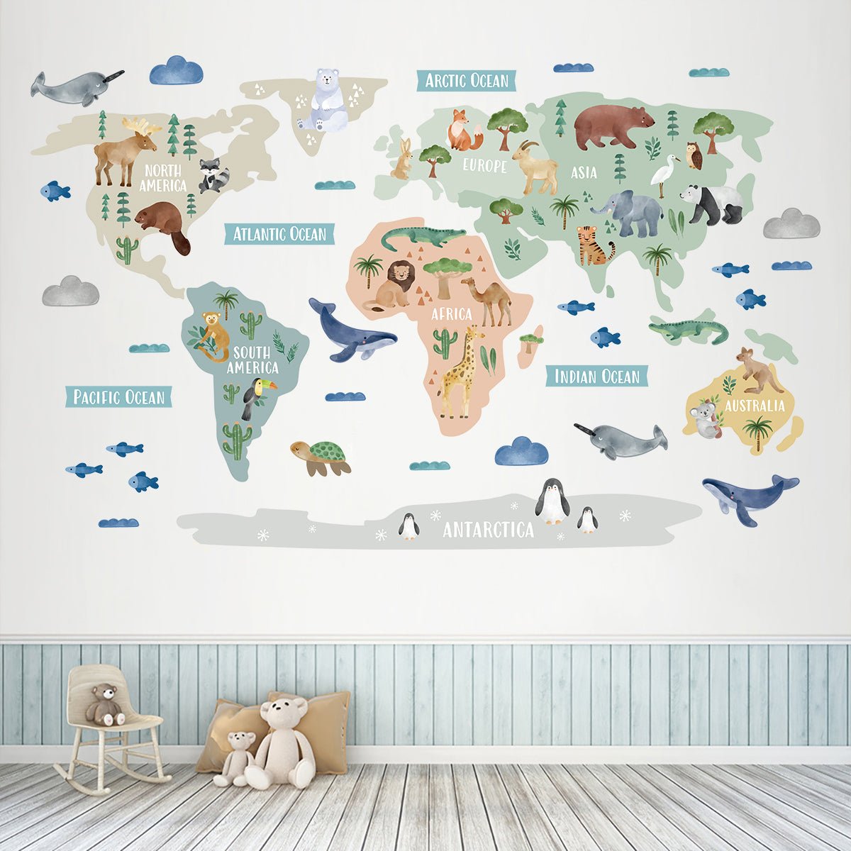
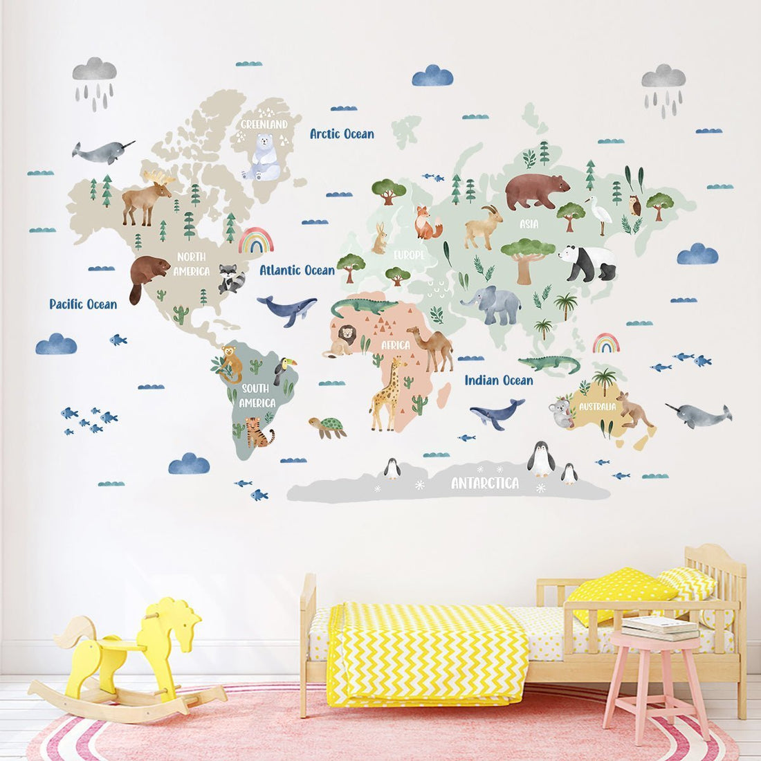
World Maps
World maps provide a global perspective and introduce children to all seven continents. They introduce continents, countries and major features. They encourage curiosity about global cultures, climates, and wildlife, promoting a sense of global awareness.
Country Maps
Country maps focus on a specific country and provide detailed information about its regions, cities, and landmarks. These maps help children learn about the geography, culture, and history of individual countries. They are valuable tools for fostering an appreciation of diversity.
Thematic Maps
Thematic maps highlight specific topics, such as climate, population density, or natural resources. These maps help kids understand the relationship between different factors and how they vary across regions. Thematic maps encourage critical thinking and help children develop a deeper understanding of global issues.
How to Use Maps for Learning Activities
Incorporating maps into learning activities can further enhance their educational value. Here are a few suggestions on how to utilise maps for interactive learning:
Map Reading Skills
Teach children basic map reading skills, such as understanding directions, using a compass, and reading map legends. Engage them in activities where they have to follow a map to reach a specific destination or solve a puzzle.
Fun Map Games and Puzzles
Make learning enjoyable by incorporating map-themed games and puzzles. This could include treasure hunts, geography quizzes, or jigsaw puzzles of maps. These activities reinforce knowledge while keeping children entertained.
Incorporating Maps into Lesson Plans
Maps are versatile tools that enhance learning across subjects. In history, they show how borders and civilisations have changed over time; in science, they help explain ecosystems and climate. Integrating maps into lessons makes learning more engaging and interdisciplinary.
When selecting a kids map, consider its educational value, interactivity, and age-appropriate design. Maps go beyond geography, they boost cognitive skills, spark curiosity, and encourage exploration.
Maps also promote global awareness and empathy. By exploring maps that highlight different cultures, languages, and landmarks, children can develop a sense of global citizenship and appreciation for diversity.
Maps also fuel imagination! Kids can create fictional worlds, building storytelling skills and encouraging collaboration through shared creative projects with their friends to build a shared imaginary world, fostering teamwork and cooperation.